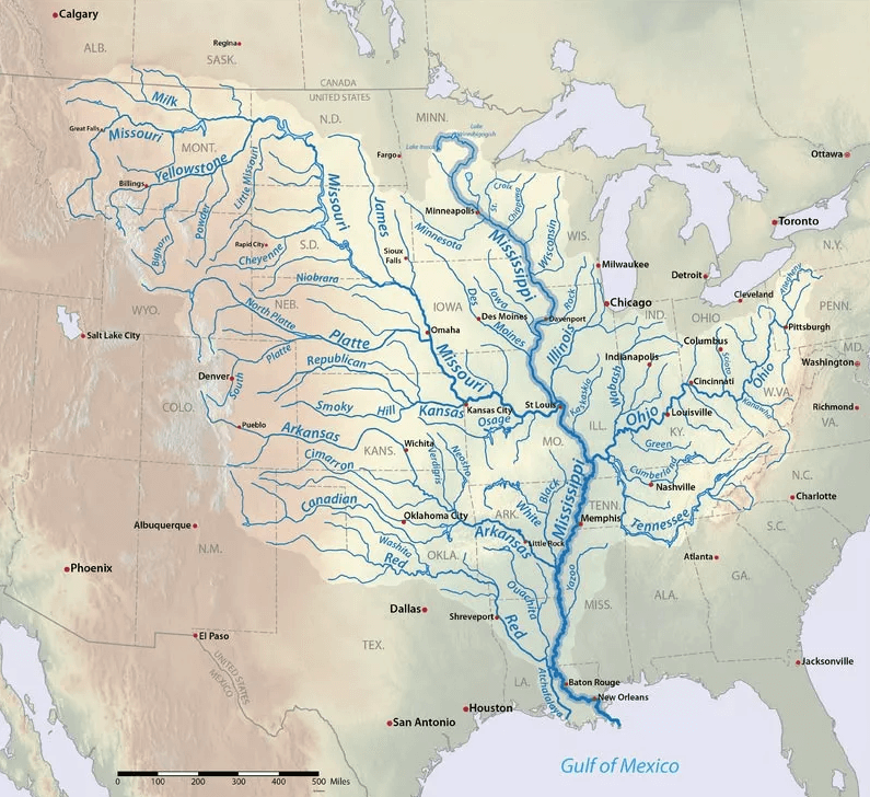
This is a map of the Mississippi River Basin in the United States.
The main river stretches the central and eastern parts of the country, in addition to two Canadian provinces. According to Britannica, its total distance is 2,340 miles (3,766 kilometers), making it the longest river in North America. It is also the fourth largest river in the world, as noted by National Geographic.
On the map, it is shown that the Mississippi has plenty of rivers connecting to it, which are known as tributaries. The U.S. Environmental Protection Agency estimates them in the “hundreds” making up over 1.2 million square miles (3.2 million square kilometers) worth of drainage basin.
Check these books out to know more about the famed river and what fun activities to do there:
- Mississippi River: Headwaters and Heartland to Delta and Gulf
- The Place with No Edge: An Intimate History of People, Technology, and the Mississippi River Delta
- Bicycling Guide To The Mississippi River Trail: A Complete Route Guide Along The Mississippi River
- Mapping the Mississippi River (Real Life Readers)
- Mississippi River Tragedies: A Century of Unnatural Disaster
Help us out by sharing this map: