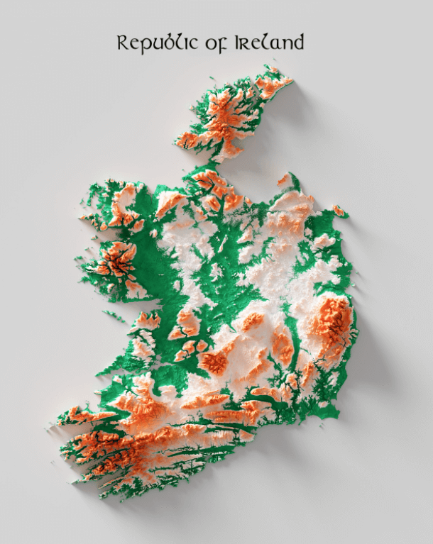
This is a map of the Republic of Ireland. It is colored according to the country’s flag.
The lowlands are marked in green. Those covered in white represent a plain separated by hills, according to the NASA Earth Observatory.
The orange areas of the map represent the high, mountainous areas. NASA says that each of these mountain ranges is of a different material. For instance, the southern mountains are made of red sandstone, the western and eastern ranges have granite, and basalt in the northeast.
Maps.com notes that the mountain peak Carrauntoohil, located in the southwest, is the country’s highest point, standing at 1,038 meters (3,046 feet) above sea level. Two of its neighboring peaks in the same mountain range also stand at over 1,000 meters high. A marsh located in Belfast, Northern Ireland (UK) is considered the island’s lowest point, at only 1.3 feet (-0.04 meters) below sea level.
If you have Ireland on your travel list, plan ahead and check out these books:
- Fodor’s Essential Ireland 2021
- Ireland: A Luminous Beauty
- Ireland’s Forgotten Past: A History of the Overlooked and Disremembered
- How the Irish Saved Civilization: The Untold Story of Ireland’s Heroic Role From the Fall of Rome to the Rise of Medieval Europe (The Hinges of History)
Help us out by sharing this map: