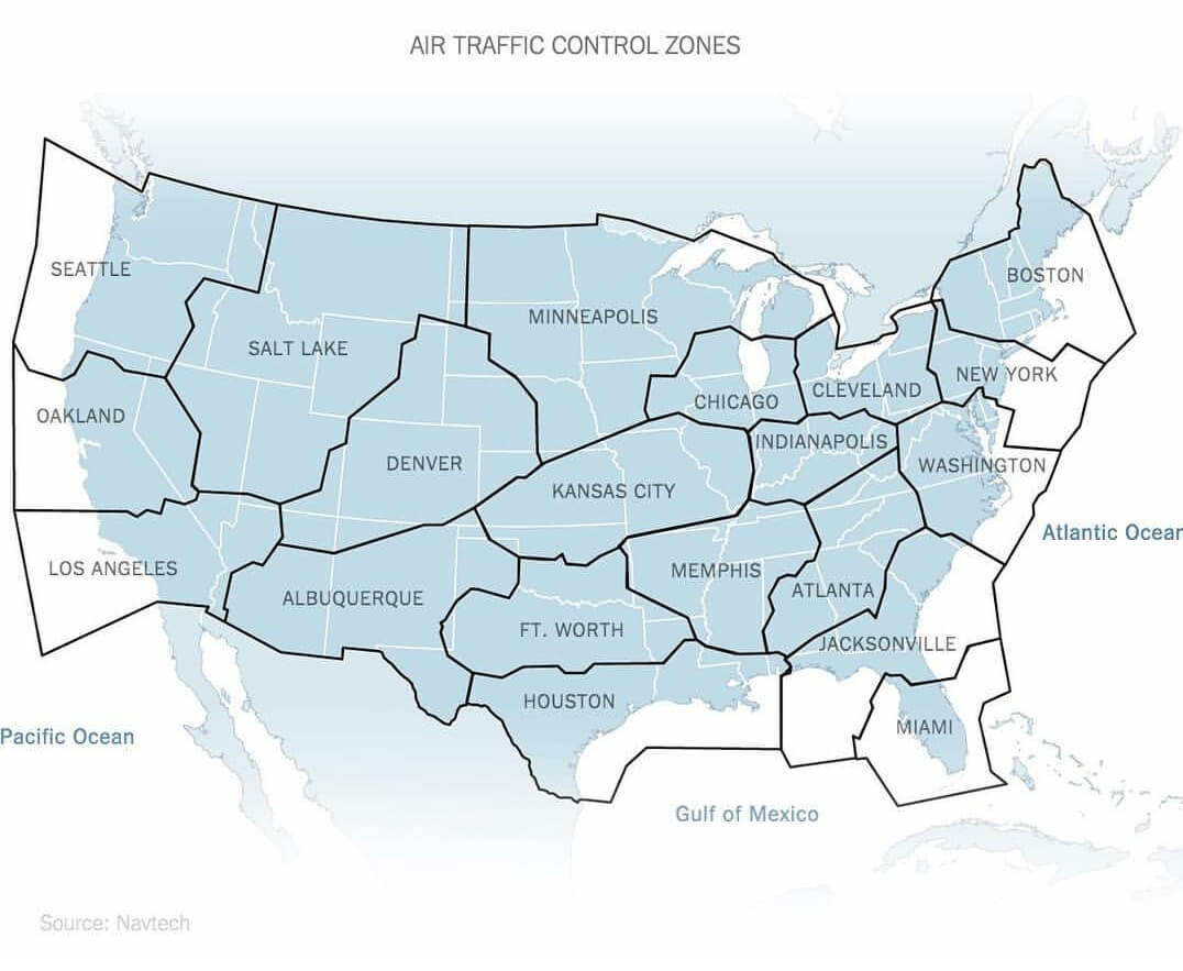
The above map depicts the various air traffic control (ATC) zones throughout the contiguous United States. There are a total of 20 ATC zones throughout the mainland U.S.
ATC zones are designated airspaces surrounding airports where air traffic control services are provided to manage the safe and efficient movement of aircraft. These zones are essential for coordinating takeoffs, landings, and general aircraft operations in busy airport environments.
The various features of these zones include:
- Each zone’s proximity to multiple airports
- Its vertical and horizontal coordinates on the map
- Controlled airspaces, which means pilots must seek permission before entering each zone
- Separation of aircraft to avoid mid-air collisions
- Types of flights, which can either be under instrument flight rules (IFR) or visual flight rules (VFR)
As you can see on the map, the Minneapolis Center (ZMP) and Salt Lake City Center (ZLC) are the two largest ATC zones in the U.S., as they cover seven and six states, respectively.
Interestingly, two states each boast two ATC zones named after each city in their state:
- Texas has both the Fort Worth Center (ZFW) and the Houston Center (ZHU).
- Florida has both the Jacksonville Center (ZJX) and the Miami Center (ZMA).
Love this map? Leave a comment below or share it forward!